Johns Creek joins Waze to help motorists navigate the city faster, safer.
Johns Creek is now part of Waze’s Connected Citizens Program, which aims to help local commuters navigate their cities more easily. It’s a mutually beneficial partnership, where Johns Creek will provide certain data to Waze, such as major events and road closings. In return, Waze’s crowdsourced data will help the city better understand traffic patterns, reduce congestion and improve commutes and car rides for local drivers overall.
A first partnership of its kind in Georgia, the city of Johns Creek is partnering with Waze, the world’s largest crowd-sourced, traffic-navigation phone app, to give motorists timely notice of road construction and incident data as they drive through the City.
Anything to make traffic move better and the roads safer in Georgia, is a great idea.
“Johns Creek has a very sophisticated traffic tracking system, and this partnership with Waze allows us both to help commuters avoid traffic delays and get through the City more easily,” said Mayor Mike Bodker. “We are proud to be the first in Georgia to embrace this new technology to better serve our citizens.”
Johns Creek is also the eighth city in the United States to partner with Waze. Other cities include Boston, Los Angeles, and Washington D.C.
Nick O’Day, Johns Creek Geographic Information System manager, said under the arrangement, Waze and the City will share streams of information, multiplying the effectiveness of each other’s operations.
“We will share information with Waze, such as road closings, accidents, and major events that affect traffic,” O’Day said. “In return, they will help us better understand traffic patterns and help reduce congestion in our City. This partnership is clearly a ‘win-win’ for both Waze and the City, but even more so for the public.”
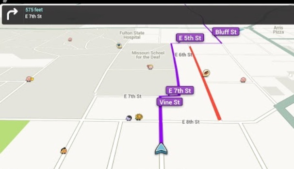
Waze is a Google-based smart phone app that monitors traffic in real time. Waze has millions of users worldwide, called Wazers, who use the app to help them find the quickest routes. Under Waze’s Connected Citizens Program, cities and citizens collaborate to provide Waze users with warnings of traffic jams and road hazards on their route. Waze takes that constantly updated information and makes recommendations for the fastest route to a destination.
Warnings and recommended routing are possible because Waze taps into the GPS of subscribing motorists’ smart phones. To paint the picture of the traffic situation at any given point at any given time, Waze collects and shares the combined GPS data from its subscribers. Plus, Wazers can provide live reports about traffic congestion, accidents, and obstacles. The City will enhance Waze reports by adding its own updates, which contain location, duration and effect of planned maintenance on roads as well as incidents that might impact traffic.
With the addition of City data, Wazers will be even safer on the roads and more knowledgeable about construction, marathons, floods or anything else that can cause delays. And for communities, real-time information from drivers is essential; no one knows more about what’s happening in a city than the people who live there.
Johns Creek already collects and posts road construction, road closures, and special events on its Road Information Map. Eventually, the City will overlay Waze maps over the Road Information Map, allowing the City to share Wazer/City information to City map users.
Download the Waze app and see if it makes your life easier.


